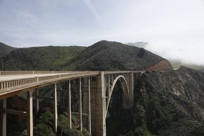

Katie Rodriguez here, reflecting on how hectic it was on Labor Day weekend on Highway 1 heading down into Big Sur.
It was a beautiful weekend—the last hurrah of the summer for many families—so it wasn’t a surprise seeing cars piled up on the side of the highway, every available parking space filled.
Quantifying this number of people, not just on holiday weekends but year-round, is something that the Community Association of Big Sur (CABS) has been keen on doing for some time. It’s now come to fruition, with the data being officially released to the public the first week of September.
The last time a traffic study was done was in 1977, says Patte Kronlund, executive director of CABS. And real-time data like this is important to many groups, both local and statewide.
“It all goes back to highway capacity and what the Big Sur Land Use Plan spoke of,” Kronlund says. “It's important to know for the businesses, the residents, the traveling public, tourism and the state. Understanding the number of vehicles coming and going helps for better planning and management.”
The Land Use Plan, which provides legal guidelines for managing Big Sur and was adopted in 1986, states: “In light of the anticipated traffic increases on the Coast Highway, the County shall review traffic levels after five years and determine what capacity improvements have been implemented or planned, and what additional solutions may be necessary and feasible.”
CABS helped raise more than $120,000 for the data project to hire contractors with Bear Electrical Solutions, install equipment, conduct surveys and manage permitting. The traffic counter—the device that collects the data—was installed near Malpaso Creek Bridge, embedded under the highway to tally the number of cars driving over it in both directions. In July, the numbers of vehicles varied between 5,310 to 8,817 daily.
The biggest lift was permitting. “That just took time,” Kronlund says.
The data is intended to be shared widely with residents and businesses, government agencies that include Caltrans, the County of Monterey, the California Coastal Commission and Highway Patrol, as well as tourism organizations such as See Monterey.
At the moment, there is just one traffic counter that’s embedded on Highway 1, with plans to install another one on the south side at some point in the future.
For now, CABS is collecting the raw data monthly and turning it into visual graphs, which are distributed through its existing email list.
Whether you’re a data nerd, or just want a better idea of when to head down to grab lunch at Nepenthe without the crowds, you can check it out here.


(0) comments
Welcome to the discussion.
Log In
Keep it Clean. Please avoid obscene, vulgar, lewd, racist or sexually-oriented language.
PLEASE TURN OFF YOUR CAPS LOCK.
Don't Threaten. Threats of harming another person will not be tolerated.
Be Truthful. Don't knowingly lie about anyone or anything.
Be Nice. No racism, sexism or any sort of -ism that is degrading to another person.
Be Proactive. Use the 'Report' link on each comment to let us know of abusive posts.
Share with Us. We'd love to hear eyewitness accounts, the history behind an article.