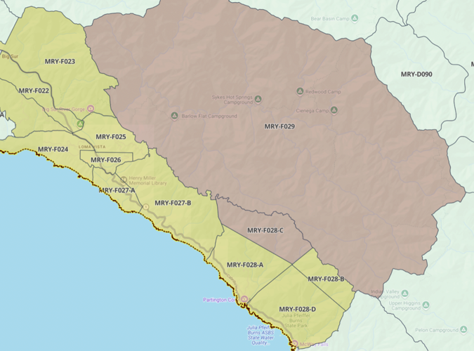
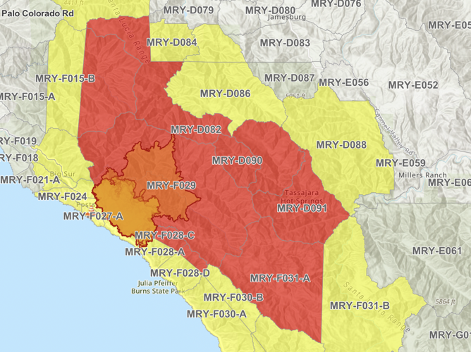

UPDATE as of 1pm Sunday, Aug. 23: Additional evacuation zones to the east and northeast are now under evacuation orders due to the Timber Fire.
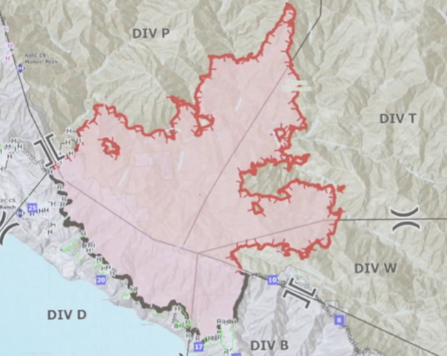
Even as firefighters have made progress with containment of the Timber Fire in Big Sur on the west side, the fire continues to grow in steep wilderness terrain to the north and east.
On Saturday, Aug. 22, Highway 1 was fully reopened to through-traffic in the area, leading to the reopening of various businesses that had been closed due to lack of access.
But due to dry weather conditions overnight from Saturday to Sunday, Aug. 22-23, the fire continues to be active on its northeastern side. As of 7am Sunday, Aug. 23, the U.S. Forest Services reports it has burned 9,665 acres and is 25-percent contained.
"Out to the east, fire activity picked up and has burned continuously throughout the night," Operations Section Chief Nolan Hale reported in a Sunday morning briefing. "We are monitoring that very closely and moving resources appropriately."
Firefighters had been hoping to keep the fire south of the Big Sur River on its northeastern side, but it is now burning on both sides of that canyon, fire officials report.
"On the northeastern side, the fire is well established north of the Big Sur River in the Lion Creek drainage and perimeter growth is expected to the north near Ventana Cone," according to the U.S. Forest Service.
Warm and dry conditions in the most active areas of the fire are expected to continue, with variable winds in the forecast.
Firefighters continue working on contingency lines to protect nearby communities, according to Hale, including strengthening Coast Ridge Road to the south (which serves as the fire line).
Meanwhile, most evacuation orders in Big Sur have been downgraded to warnings, meaning residents should be prepared to evacuate in case of orders. At about 1pm on Sunday, Aug. 23, officials issued new evacuation warnings throughout swaths of the Los Padres National Forest to the north and northeast, including Tassajara Zen Center and some areas east of Tassajara Road.
Los Padres National Forest trails and roads in the area remain closed to the public.

The area in red is under evacuation orders as of 1pm Sunday, Aug. 23. (The area in yellow indicates evacuation warnings, meaning residents are advise to be prepared to leave if orders are issued.) For up-to-date maps and notification and to receive alerts, visit readymontereycounty.org.


(0) comments
Welcome to the discussion.
Log In
Keep it Clean. Please avoid obscene, vulgar, lewd, racist or sexually-oriented language.
PLEASE TURN OFF YOUR CAPS LOCK.
Don't Threaten. Threats of harming another person will not be tolerated.
Be Truthful. Don't knowingly lie about anyone or anything.
Be Nice. No racism, sexism or any sort of -ism that is degrading to another person.
Be Proactive. Use the 'Report' link on each comment to let us know of abusive posts.
Share with Us. We'd love to hear eyewitness accounts, the history behind an article.