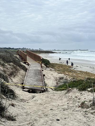

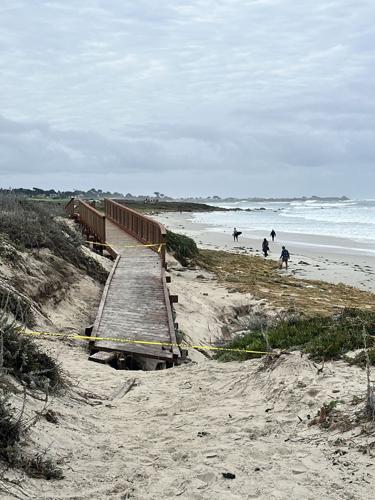
The storm that blew through the Monterey Bay region from late Friday, Nov. 13 to through Sunday, Nov. 15, battered the coastline with waves measured at over 30 feet tall, throwing up rocks and other debris onto shoreline roads, as well as damaging boardwalks and trails.
Now more wet and cold storm systems are on the way, starting later tonight, Tuesday, Nov. 17, when rain is expected, with possible thunderstorms Wednesday and Thursday, according to the National Weather Service.
In response, the City of Carmel announced it is leaving its beach closed through at least Friday, Nov. 20, including beach access stairs.
“Do not go onto the beach. Do not go into the water. Do not go down to the sand for a closer look,” the announcement reads. “Powerful waves are surging far up the beach without warning and will sweep people and pets out to sea, even those who know our coastline well.”
The County of Monterey issued a hazard advisory for Big Sur residents just after noon on Tuesday, alerting them to the possibility of debris flows in burn areas from the Timber and Plaskett Fires. The NWS issued a flash flood watch for those areas for Wednesday and Thursday.
“It is highly likely that rainfall thresholds for debris flows and flash floods could be exceeded,” the County's advisory states. Visitors are advised to stay away from the region. Residents are encouraged to stock up on supplies and be prepared for possible road closures.
For the coastal region, winds Tuesday night are forecasted for between eight to 18 miles per hour with gusts of up to 25 miles per hour. The weather service has issued a wind advisory along the coast from 9pm, Tuesday through 1pm Wednesday.
A beach hazards statement is also in effect through at least 4pm Wednesday, with an increased risk for sneaker waves and strong rip currents that include breaking waves of 13 to 17 feet.
Wednesday’s storm will bring rain, possibly one to two inches along the coast. There’s a possible afternoon thunderstorm with winds between 24 to 29 miles per hour and gusts of up to 44mph. Thursday will also be wet, but not as much rain, about a quarter to a half an inch.
The forecast for inland Monterey County on Wednesday is for rain and a possible thunderstorm and a high near 58 degrees. Winds are expected to be between 17 and 22 miles per hour with gusts up to 34mph. Rainfall amounts are expected between three quarters of an inch and an inch.
On Thursday, Salinas and the Salinas Valley will see more possible showers and a thunderstorm before 10am, then more rain with wind gusts of up to 38mph. The skies clear up on Friday, with rain returning Saturday evening.
The forecast on the coast for Friday and the weekend includes more possible showers each day, with rain Friday morning and some clear skies until Saturday evening. The temperatures will be in the low 60s during the day and high 40s at night.


(0) comments
Welcome to the discussion.
Log In
Keep it Clean. Please avoid obscene, vulgar, lewd, racist or sexually-oriented language.
PLEASE TURN OFF YOUR CAPS LOCK.
Don't Threaten. Threats of harming another person will not be tolerated.
Be Truthful. Don't knowingly lie about anyone or anything.
Be Nice. No racism, sexism or any sort of -ism that is degrading to another person.
Be Proactive. Use the 'Report' link on each comment to let us know of abusive posts.
Share with Us. We'd love to hear eyewitness accounts, the history behind an article.