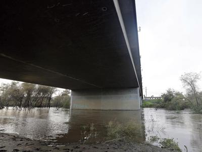

Since New Year’s Eve, the Pajaro River was one of several rivers officials watched closely as the water level rose amid storms that pounded the Central Coast. The Pajaro River watershed drains 1,300 square miles across four counties. Rainfall far upriver can take days to flow to the Monterey County community of Pajaro, population 3,000.
It wasn’t just the height of the river, but its levees that put officials on alert on both sides, in Monterey County (on the south bank) and Santa Cruz County (on the north). Rising water brought back memories of flooding in 1995 that devastated the Pajaro community and resulted in $95 million in damages, and a more recent flooding scare in 2017.
“We are aware of the things that went wrong in ’95 and we are hoping not to repeat those,” Sheriff Tina Nieto said at a press conference in Pajaro on Jan. 8. She urged Pajaro residents to abide by evacuation orders that lasted over a week, from Jan. 9 to 17.
Mark Strudley, executive director of the Pajaro Regional Flood Management Agency (PRFMA), says agency officials worked in conjunction with local agencies in monitoring forecasts and generating flood models. They used that information to reinforce weak areas along the levee. They also installed a muscle wall, a type of portable barrier. “[It was] a way of gaining a little bit of extra height and extra factor of safety against the flood flows that were forecast to come down the river, because we didn’t want the levees to overtop,” Strudley says. Crews also installed seepage berms – large rock supports – to prevent leaks.
“Every measure we took wasn’t luck-based, it was based on calculated knowledge,” Strudley says.
The Pajaro community didn’t flood, due to a combination of planning and luck. Forecasts showed the levees overflowing, which did not happen. “The flows that were expected were much larger than the levee system could contain, no matter what we did to it,” Strudley says.
“It really could have been a lot worse, had there not been that kind of teamwork done by multiple jurisdictions,” says County Supervisor Luis Alejo, also a PRFMA board member.
Other communities weren’t as lucky. On Jan. 1, Corralitos Creek overflowed, affecting a retirement community in Watsonville, as well as agricultural fields. And on Jan. 9, the Pacheco Creek Dam overflowed in Hollister.
Now that the emergency is over, PRFMA will continue to remove vegetation and clean and replace damaged culverts that are underneath the levee.
The levee has been on the U.S. Army Corps of Engineers’ reconstruction list for over 50 years, and last year it got needed federal funds for a $400 million project to prevent flooding.
In June 2022, property owners in PRFMA’s area voted overwhelmingly (79 percent) to pay a tax assessment to maintain and manage the levee.
Corralitos Creek, where the recent flooding occurred, doesn’t have any levees. “That is the first spot we are prioritizing for new levees with the Army Corps of Engineers,” Strudley says. Construction is expected to begin in 2025.


(0) comments
Welcome to the discussion.
Log In
Keep it Clean. Please avoid obscene, vulgar, lewd, racist or sexually-oriented language.
PLEASE TURN OFF YOUR CAPS LOCK.
Don't Threaten. Threats of harming another person will not be tolerated.
Be Truthful. Don't knowingly lie about anyone or anything.
Be Nice. No racism, sexism or any sort of -ism that is degrading to another person.
Be Proactive. Use the 'Report' link on each comment to let us know of abusive posts.
Share with Us. We'd love to hear eyewitness accounts, the history behind an article.