
IF NOTHING IS DONE, a portion of northern Monterey County could lose access to aquifers that underlie a significant chunk – call it 25 percent – of the county’s agricultural production, and supply drinking water to hundreds of thousands of residents, 50,000 of whom are disadvantaged.
The sea wants to move inland, a fact that’s been known in the region for over 80 years as agricultural production increased.
But over time, groundwater was pumped faster than could be replenished, exacerbating the inland march of salty water beneath Castroville toward Salinas. Eventually, the state said that something needed to be done about it.
How to stop the ocean from spreading and further contaminating these freshwater aquifers – specifically, what’s known as the 180/400 Subbasin – has become one of the region’s defining environmental and political questions. Thanks to California’s Sustainable Groundwater Management Act, passed just over a decade ago, local water agencies need to decide on a plan to protect future water supply. In 2015, that countdown began.
Monterey County, along with other regions in California with critically overdrafted groundwater basins, began a decades-long effort to bring groundwater use into balance by 2040. Now, 2026 marks a pivotal year. All of the groundwater modeling, the public meetings, the basin boundary decisions and feasibility studies of the last 10 years culminate in this moment, where local agencies must push plans across the line into implementation.
As projects have begun to emerge, their costs, impacts and feasibility have been heavily scrutinized and debated as a fast-approaching deadline approaches: By August, plans must be provided to the California Department of Water Resources (DWR) for review.
If a solution isn’t proposed and approved by DWR, the state could assume control of local water sources, imposing pumping restrictions and fees – although whether or not these pumping cuts would be valley-wide is up for debate. While the exact impact to the county’s largest industry, agriculture, remains unclear, officials underscore the cost and ripple effects will be huge.
Estimates from water experts project annual economic losses of anywhere from $1.3 to $1.9 billion if pumping restrictions are imposed.
But while the cost of doing nothing is high, so is the cost of doing something.
“The greatest fear that we have among the grower community right now is how much this is all going to cost,” says Norm Groot, executive director of the Monterey County Farm Bureau. “The projects that we’re facing are astronomically expensive, over $1 billion in proposed projects, probably closer to $2 billion. That’s just an astronomical number that the community is worried about.”
Though mitigating seawater intrusion remains the top priority, other subbasins face their own urgent challenges and deadlines, and must meet sustainability requirements by 2042.
But in a world where water knows no boundaries, yet is regulated within a fragmented governance structure, the question persists: Who benefits, and who pays?

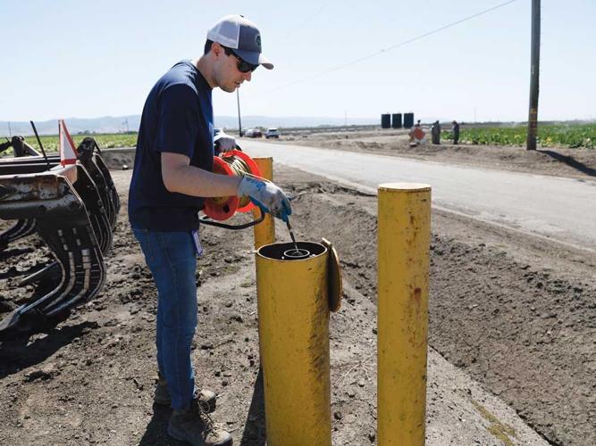
Wells used to monitor groundwater levels are scattered across the Salinas Valley. Above, Guillermo Diaz-Moreno, a hydrologist with the Monterey County Water Resources Agency, collects data from these wells monthly.
THE YELLOW POSTS that dot the Salinas Valley easily go unnoticed. Each one marks a monitoring well, protected by a yellow metal casing, scattered across roadsides and agricultural fields. Hydrologists with the Monterey County Water Resources Agency visit 130 of these each month to get a picture of how groundwater levels in the Valley’s aquifers are changing.
“[Some areas] tend to see faster recharge since they’re next to the river,” says Guillermo Diaz-Moreno, a hydrologist with MCWRA who collects data from wells from Castroville all the way to San Ardo. “But overall, there’s been a decline since we started measuring.”
Underneath our feet is a vast and largely unseen world of water, its movement monitored and increasingly, though not completely, understood.
Since the 1940s, MCWRA has been measuring groundwater levels, historically relying heavily on privately owned wells for data.
As people drilled additional and deeper wells over time, the agency has accumulated decades of historical records. Combined with data from its own monitoring wells, and data collected from the U.S. Geological Survey, hydrologists gained an understanding of the valley’s water table and underground sediments, forming the basis for groundwater models now used under SGMA.
“We have a really large effort that we usually do in November-December, when pumping has slowed down but before we tend to get winter rain to help us understand how much the natural system is recovering as we decrease pumping,” says Amy Woodrow, senior hydrologist at MCWRA. More intensive groundwater monitoring hinges on water usage by agriculture, she explains.
All of this knowledge gave the County an advantage when it came to understanding our groundwater systems, how it can be stored and how people depend on it – influencing nearly every decision about water management – and eventually shaping projects for SGMA.
“Water always flows downhill,” SVBGSA Advisory Committee Chair Curtis Weeks says, “or towards money.”
YEARS BEFORE SGMA, the subbasins that make up the Salinas Valley were mapped to reflect how groundwater moves underground as it travels from the southern parts of the county and northward alongside the Salinas River, before emptying out into the Pacific Ocean.
Groundwater in California during this time went largely unregulated. Scientists and water managers had ways to observe what was happening underground, but few effective tools to manage it strategically.
Legal pressures mounted, then came years of drought. Beginning in 2012, groundwater basins in agricultural areas experienced drastic declines. Land subsided, some wells ran dry. In the coastal area of Castroville and Moss Landing, abnormally dry conditions furthered the spread of seawater into the shallow aquifers.
Following a declaration of a drought state of emergency, the California Legislature passed SGMA, signed by former Gov. Jerry Brown.
“Groundwater management in California is best accomplished locally,” said Brown in signing SGMA. The legislative package required local agencies to form groundwater sustainability agencies (GSAs), then develop groundwater sustainability plans (GSPs) for basins that were designated by SGMA as high or medium priority.
The hydrological boundaries of the Salinas Valley were then transformed into legal management units. The six primary subbasins today that make up the Salinas Valley Groundwater Basin include: 180/400-foot Aquifer Subbasin, Eastside Aquifer Subbasin, Forebay Aquifer Subbasin, Langley Area Subbasin, Monterey Subbasin and the Upper Valley Aquifer Subbasin.
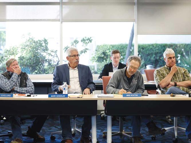
Through this process the Salinas Valley Basin Groundwater Sustainability Agency (SVBGSA) was formed, governed by a board of 11 directors, each member representing different interests across the Salinas Valley. This group, which will recommend a suite of projects to the state in about a month, consists of a number of people representing agricultural interests, South County cities, disadvantaged communities, environmental interests and the City of Salinas. Each subbasin has its own committee, and another advisory committee made up of roughly 13 members and chaired by Weeks makes recommendations to the board.
“There’s all these different entities,” says County Supervisor Glenn Church, who also serves on the SVBGSA board. “Everybody goes to their corner and argues for themselves, and those days are over. We’re going to have to come up with some common solutions.”
A veteran in the world of water, Derrik Williams has been studying where it goes and how it flows for over three decades. As a technical consultant for a firm called Montgomery & Associates, he’s been working with the SVBGSA as a project manager, explaining how seawater intrusion works and how the sediments underground distinguish our subbasins.
Aquifers are often classified as confined or unconfined. Unconfined aquifers are “like your sink,” Williams says. “Think of it as a bowl of gravel and sand.” Underground, there might be layers of clay, sand, silt and rock, forming ribbons and pretzel-like patterns that shape how water moves; generally, towards the sea.
The 180/400 Subbasin is a confined aquifer, meaning layers of sediment separate groundwater at different depths. The “180” and “400” aquifers, named for their approximate depth in feet below the ground, sit above a deeper aquifer at around 800 feet. Beneath those lie even deeper aquifers, about which relatively little is known.
“Some people push back and say, but our subbasins are different, and they are different,” says Williams. “This is going to be the balancing act, how you bring the entire valley into sustainability. Because it will probably take the entire valley, knowing that you are hydrologically benefiting some parts of the valley more than others. Economically you might be benefiting the entire valley equally, but that’s different than hydrologically benefiting one area.”

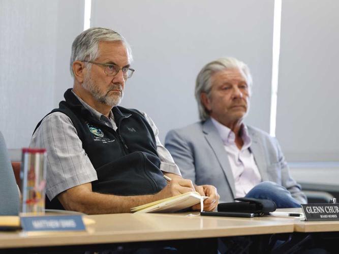
The Salinas Valley Basin Groundwater Sustainability Agency and Monterey County Water Resources Agency held a joint workshop on May 18 in Salinas.
THE THYME ROOM at the County of Monterey’s Schilling Place campus in Salinas smells of garlic, maybe onions. Windows are open, but the air is thick with heat and unanswered, high-stakes questions. Meetings happen here often, but this one matters: for the first time, the board of directors of the SVBGSA – 11 representatives reflecting different interests across Monterey County – are getting an overview of projects that will shape the region’s water future.
In August, this group will recommend a portfolio of projects to the state.
“We only have so many flavors of water to work with,” Weeks told the board May 14. “To get to sustainability by 2040, it takes a huge project.”
The equation is simple in theory. New water can only be created in a few ways: rain, desalination and recycling. And seawater intrusion can only be staved off in a few ways: by reducing groundwater pumping or injecting water back into the aquifer. Most proposed projects rely on some combination of both.
That framework forms the basis of nearly every proposal under consideration: finding water that is available, reliable and ideally, cost-effective. “Demand management,” or reducing groundwater use, is viewed as part of the end-solution, but not sufficient on its own.
Several systems already divert water from the Salinas River and deliver irrigation water to agricultural areas impacted by seawater intrusion.
The SVBGSA has built upon those existing systems to develop what Piret Harmon, the agency’s general manager, calls a “menu” of projects. Each is evaluated based on how effectively it meets “minimum threshold” goals for stopping seawater intrusion and raising groundwater levels.
One existing example is the Castroville Seawater Intrusion Project (CSIP), which already delivers recycled water to farmers, supplying water to roughly 12,000 acres of farmland in northern Monterey County. Castroville has long been viewed as ground zero for seawater intrusion. A 2026 civil grand jury report noted that the number of active wells dropped from 22 to nine over time as saltwater contamination forced users to abandon their wells.
In the late 1990s, CSIP was launched to reduce freshwater pumping in one of the county’s most productive agricultural regions. The project supplies treated wastewater by Monterey One Water, a regional treatment plant located in Marina, to growers for irrigation.
Now, a proposed expansion – the New Seawater Intrusion Project (NSIP) – could push that model further inland. The concept would build a new distribution system, supplying recycled water to agricultural land between the existing CSIP service area and the City of Salinas, along with some urban users.
But that comes with a price tag. Capital costs could reach beyond $700 million for a project that doesn’t solve seawater intrusion.
“Understand that all models are compromises,” Weeks said, “at least with some relative tool that allows us to evaluate them. They’re not perfect.”
Another proposal focuses on capturing excess water in wet years and storing it underground for later use, a process known as aquifer storage and recovery. Estimated capital costs range from $278 million-$383 million, without solving seawater intrusion, and is also dependent on rain.
The Castroville and Eastside Canals would similarly use Salinas River water to recharge groundwater basins by injecting water back underground. The goal is to raise groundwater levels in the 180/400 and Eastside Subbasins, slowing seawater intrusion while supporting groundwater recovery in the deep aquifers.
Hurdles abound with this concept as well. Capital costs range from $195 million to $1.3 billion, the project does not meet the minimum threshold for seawater intrusion, and is dependent on rainfall. It also requires significant changes to a water permit that restricts water storage.
“The permit says you can divert 135,000 acre-feet, which is a crazy amount of water, way more than anyone needs,” says Chris Bunn, a grower and president of the Salinas Basin Water Alliance, a group formed in 2020 for growers to engage with public policy involving groundwater supply. Bunn also sits on the SVBGSA advisory committee and is on the board of directors for the Monterey County Farm Bureau. “But you can’t store it. You have to [use] it within 30 days, so it’s useless because nobody’s irrigating. We need the water during the growing season.”
Only one project alone solves the issue of seawater intrusion in the 180/400-foot aquifers, the biggest, most ambitious and controversial project known as the brackish groundwater restoration project. The concept involves a hybrid approach: constructing extraction wells along the coast to intercept seawater intrusion, treating that water with reverse osmosis, then reinjecting it back into the aquifer to add enough pressure to stop seawater intrusion.
It is the only project projected to both stop and reverse seawater intrusion while protecting multiple subbasins. Because it does not rely on rainfall, it is also considered drought resilient. It would improve groundwater quality and protect additional subbasins, including the Eastside, from future seawater intrusion.
Yet the cost is the highest: roughly $951 million in capital costs and another $113 million annually in operating costs.
“They’re all expensive,” Harmon said at the meeting. “There is no really easy, low-hanging, non-expensive solution. All of them are portfolios. But they are distinctly different in terms of who’s receiving benefits from each project.”
And that is not necessarily a question of hydrology, but one of culture, geography and politics.

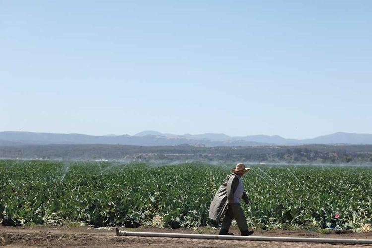
About 95 percent of groundwater used in Monterey County supports agriculture, with over 200,000 acres of land in cultivation in the Salinas Valley.
DRIVING FROM CASTROVILLE, through Salinas to Gonzales, Greenfield and King City, the road is flanked by acres upon acres of leafy greens, cruciferous vegetables and strawberries, crops that help make Monterey County the fourth-highest agricultural-producing county in California. In 2024, the county generated $5 billion in gross agricultural value. Strawberries alone surpassed $1 billion in value that year, the first crop to reach that threshold in the county’s history.
Despite those numbers, many farmers face mounting and in some cases, crippling, financial pressure. Consolidation in the specialty crop market regionally has pushed out smaller growers unable to keep up with climbing regulatory prices and agricultural input costs.
“The incremental add-on of regulatory burden over the years is one of the main reasons why farming has changed so much in the valley over the last 30 years,” says Bunn, whose family used to farm thousands of acres in the area before scaling back in the 1990s following record-breaking floods, and later, after the first E. coli outbreak. “That started to greatly change the economics of farming, so we sort of saw the writing on the wall at that point, because we’re not that big.”
An estimated 95 percent of water used in Monterey County is pumped from groundwater aquifers to support over 200,000 acres of land in cultivation in the Salinas Valley.
Those aquifers, in effect, also help feed much of the country. Monterey County produces 28 percent of U.S. strawberries – nearly one out of every four eaten nationwide. The numbers climb even higher for other crops: 48 percent of the nation’s broccoli, 57 percent of its celery and 61 percent of its leaf lettuce.
“Unfortunately, because agriculture is responsible for 90 percent of the extractions every year, I think the overall presiding presumption is that we will pay 90 percent of the project,” Groot says.

Supervisor Glenn Church is also a board member for the SVBGSA, and will be among those recommending a portfolio of projects to the state in August. Much of his district is in the area most vulnerable to groundwater impacts, as the 180/400-foot subbasin underlies Castroville and the northern Salinas Valley.
THE STAKES FOR CASTROVILLE AND SALINAS, as well as the indirect costs to the rest of the County, are high. Households on domestic wells would continue to lose access to drinking water, and pumping restrictions would lead to fallowing, with large portions of farmland taken out of production, risking disruption of the broader agricultural economy.
“If you have a lower capital cost project portfolio, yes, that saves some money, but we need to look at how that weighs against costs that are being imposed on folks. That’s the trade-off,” said Duncan MacEwan, an economist with ERA Economics working with the SVBGSA, during an advisory committee meeting on June 18. “There’s no free lunch.”
The portfolio of projects would mix and match brackish water desalination, NSIP, demand management and others, although the ultimate scale is yet to be determined, as has the funding strategy, leaving many still uneasy.
Experts have discussed pursuing outside funding from a mix of federal grants through the Bureau of Reclamation, or state bond funds through Proposition 4 for water-related infrastructure programs. DWR programs, such as the multibenefit land repurposing program, could also provide additional funding, which provides grants to convert agricultural land to less water-intensive uses.
However, grant funding alone is unlikely to cover the costs of implementation and local funding mechanisms would be required. Fees or assessments on water users, along with cost recovery from private beneficiaries could be imposed, depending on how the projects are ultimately owned, financed and operated.
All of this remains an unknown.
In the southern Salinas Valley, where water availability appears more stable and well beyond the reach of seawater intrusion, many growers argue they have become more efficient with irrigation. As a result, some question why they should bear the cost of solving a problem concentrated farther north.
These areas are also located closer to reservoir releases and groundwater recharge flows. And while they are still considered at risk of overdraft, they are nowhere near facing the overdraft in subbasins near the coast.
Some projects reach into the billions to build, a financial burden impossible for the northern Salinas Valley to tackle alone.
Whether seawater intrusion is a valley-wide problem or just an issue for the northern Salinas Valley to solve is “the biggest bone of contention,” says Bunn, whose family historically has farmed in the lower Salinas Valley in areas prone to seawater intrusion.
John Farrow, an attorney with the watchdog group Landwatch, argues that the economic case to support the biggest project, the brackish groundwater restoration project, relies on a worst-case scenario that may never happen. It’s an argument echoed by Tom Virsik, an attorney representing growers in the southern Salinas Valley.
“The project’s economic justification depends critically on the Valley-wide uniform cut assumption, which inflates the benefit by including large losses to inland subbasins,” Farrow wrote in a letter to the SVBGSA Board of Directors and advisory committee.
“It is no secret that stakeholders fundamentally disagree whether there is any hydrological or legal rationale for compelling southern subbasins to assume responsibility to mitigate seawater intrusion. If there is no such responsibility, then it may be unreasonable to assume the [state] would order cuts to these subbasins.”
The variations in the Salinas Valley that matter to state decisionmakers may not be political or cultural, but hydrological – and it may not be viewed as one basin.
Whatever the local SVBGSA board chooses, it is just a start.
“We have a long road ahead of us,” Harmon says. “Any project that is included in the preferred portfolio will go into initial design, CEQA, permitting, funding. Any of these steps could daylight fatal flaws and may require further refinement, modification or abandonment of a project.”
Church is looking at issues of both water supply and economic sustainability for the region.
“The rippling effect is so big,” he says. “If you move that money out of there, it lowers the income base in the whole area.”
In the question of who benefits and who pays, the answer will be baked somewhere within the suite of projects the SVBGSA is set to recommend in August for consideration by the state. While the path ahead is complex, the reality may be more simple: Something’s got to change.
(0) comments
Welcome to the discussion.
Log In
Keep it Clean. Please avoid obscene, vulgar, lewd, racist or sexually-oriented language.
PLEASE TURN OFF YOUR CAPS LOCK.
Don't Threaten. Threats of harming another person will not be tolerated.
Be Truthful. Don't knowingly lie about anyone or anything.
Be Nice. No racism, sexism or any sort of -ism that is degrading to another person.
Be Proactive. Use the 'Report' link on each comment to let us know of abusive posts.
Share with Us. We'd love to hear eyewitness accounts, the history behind an article.