
Christopher Neely here, still fielding questions from friends and family around the country about last Saturday’s tsunami surge that followed the Hunga Tonga-Hunga Ha'apai volcano eruption near the Southwestern Pacific island nation of Tonga—the most significant volcanic activity in 30 years.
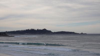
Upon receiving the “tsunami advisory” warning from the Monterey County Office of Emergency Management early Saturday morning, my mind jumped to a James Cameron-directed, IMAX-style tidal wave. Of course, it took less than 30 seconds of further reading to understand this was far from our reality on the California coast. My next thought: for the sake of our blood pressure in already trying times, perhaps we need better language to describe the 1- to 3-meter sea surge we were about to experience.
As Charlie Paull, senior scientist at the Monterey Bay Aquarium Research Institute tells me, “tsunami” is the scientific term for the set of waves that propagate on a body of water’s surface following a massive displacement of water. Paull relates it to the ripples that shoot out after a rock breaks the surface of a still pond. Unlike the wind-driven waves we see cresting near the shore, tsunamis are a consistent set of waves that travel quickly with longer wavelengths. Instead of breaking upon landfall, tsunamis push a wall of water across the land, carrying enough energy to potentially cause serious damage.
We fortunately escaped serious harm in Monterey County, faring better than parts of Santa Cruz, where the Santa Cruz Harbor reported more than $6 million in damage. According to some local scientists and researchers, Moss Landing, home to some of the most sensitive coastal land in the county, was protected by a double layer of natural features.
The first, and most important layer of protection against this tsunami was the Monterey Submarine Canyon, a mile-deep underwater canyon that essentially begins at Moss Landing’s coastline. Paull says due to the trajectory of the tsunami, much of its energy was absorbed by the canyon’s walls as the surge approached Moss Landing. Santa Cruz, says Paull, sits along a relatively straight, even shoreline that offered no buffer to the tsunami as it approached.
The other layer of protection stands as the dominant feature of Moss Landing’s sensitive coastline: the salt marshes at the Elkhorn Slough estuary. Kathryn Beheshti, a researcher with UC Santa Barbara who has studied Elkhorn Slough’s salt marshes, says the marshes provide a buffer that can similarly absorb the energy of tsunamis and storm surges. Paull says the salt marshes are definitely secondary to the Monterey Canyon’s position as the primary layer of defense, but Beheshti says they are an important natural feature in protecting people and property.
Beheshti says they operate in a fashion similar to the mangrove marsh model in this video, which shows wave energy getting almost completely dampened by the plants.
Of course, the Monterey Canyon and the salt marsh defense only goes so far. Paull emphasizes that a larger storm surge or tsunami would be able to overcome these obstacles, as seen in 2011 after the Tōhoku earthquake and tsunami, which caused almost $2 million in damage.
Paull says the scientific community is continuing to monitor the eruption site near Tonga, and that a subsequent and more powerful event is not yet off the table.
Read the full newsletter here.

(0) comments
Welcome to the discussion.
Log In
Keep it Clean. Please avoid obscene, vulgar, lewd, racist or sexually-oriented language.
PLEASE TURN OFF YOUR CAPS LOCK.
Don't Threaten. Threats of harming another person will not be tolerated.
Be Truthful. Don't knowingly lie about anyone or anything.
Be Nice. No racism, sexism or any sort of -ism that is degrading to another person.
Be Proactive. Use the 'Report' link on each comment to let us know of abusive posts.
Share with Us. We'd love to hear eyewitness accounts, the history behind an article.