It’s a hectic world. Between doctors’ appointments, car problems, work, telemarketers, traffic jams, lost keys and old-fashioned laziness, it can be hard to find the time to take a hike during the workweek. But, in the end, it is always good to get outside.
The following three hikes are all short and sweet—each one is about a one-mile roundtrip easy walk—and are centrally located so that people can take a walk on their lunch break, after work or between shopping excursions.
As an added bonus, these walks go to spots with historic and cultural significance, so when you get to your destination, spend a few minutes trying to imagine what it would be like to live in the less hectic world of our ancestors.
Mission Trail Park to Flanders Mansion
The Mission Trails Park is a 35-acre sliver of undeveloped land in the City of Carmel between Junipero Avenue and Highway 1. There are several ways to hike through the Mission Trail Park to Flanders Mansion, but I like to take the small, windy Dolittle Trail, which veers off to the right from the Serra Trail just a few feet from Rio Road.
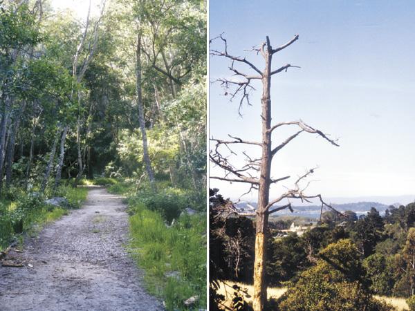
The Dolittle Trail crosses a dry creek bed, wanders through the woods and climbs to an open hillside with views of the top part of the Carmel Mission. On the right, huge century plants look like props from the Jurassic Park movies.
After dropping back on the Serra Trail, basically a fire road, for about 100 feet, the Dolittle Trail climbs up a few feet behind a wooden bench. At a three-way intersection with the Dolittle Trail, the Flanders Trail and an unnamed trail, take the unnamed trail up to a service road and take a right to the paved roundabout in front of the ivy-cloaked mansion.
Melanie Billig, the president of the Flanders Foundation, says that the seven-bedroom, five-bathroom mansion was built by San Francisco architect Henry Highby Gutterson for Paul and Grace Flanders in 1924. According to Billig, the exterior of the house, which looks like stone, is actually interlocking concrete blocks.
Off to the left of the house is the Lester Rountree Native Plant Garden featuring vegetation like buckwheat and Little Sur Manzanita. Though it is nice to wander through the garden, my favorite spot on the grounds is through the arch in the hedge to the left of the house. Here by an unsafe wooden platform, which Billig says used to be a stage for entertainers, is a great view of the Carmel Mission and Point Lobos.
Directions to Trailhead: Turn off Highway 1 onto Rio Road and drive a half mile. Park in a small dirt pullout behind a “Truck Route” sign. The park is to the right.
Quarry Park Trail
This trail connects Veteran’s Park, a hidden wooded area between Highway 68 and downtown Monterey, with Quarry Park. This 1.2-mile roundtrip trail starts at the Veteran’s Park parking lot across the street from the playground and passes downhill from some Skyline Drive homes before descending into the old quarry. On the way, the trail, which is paved in one spot, offers some good views of downtown Monterey and the bay.
After descending into the quarry, take a right on the dirt road that runs through the bottom of the man-made canyon. The area was dug out by the Guy F. Atkinson Company of South San Francisco in the 1930s to provide rock for the Monterey breakwater.
Now, despite homes being only a short distance away, the tree-lined quarry feels like a peaceful canyon located in a remote part of the backcountry. Doug Stafford, the park superintendent for the City of Monterey, likes the cottonwood trees that grow at the end of the trail.
Directions to Trailhead: Turn off Highway 1 onto Highway 68 West. Go .9 miles and take a right on Skyline Forest Drive. After only .3 mile, the road runs into an intersection with Skyline Drive. Take a left on to Skyline Drive and continue a mile to a stop sign. At the stop sign, take a right into Veteran’s Park and park in the first parking lot on the right.
Bird Rock to Indian Village
This trail in Pebble Beach takes hikers from Bird Rock on 17-Mile Drive to Indian Village, a picnic area a half-mile inland. At the south end of the Bird Rock Parking Lot, take the trail signed “Nature Trail” by the coastline, across 17-Mile Drive, over a boardwalk into the dunes to a overgrown trail in the woods, which is hard evidence that few Pebble Beach visitors venture out farther than a few feet from their cars.
The short trail ends in an open area with picnic tables, a large fire pit and a small pavilion.
According to Neal Hotelling, Pebble Beach’s historian, a legend says that this area was the site of a Native American camp where members of the tribe would gather when they were ill. Apparently, after drinking water from a nearby spring, located roughly between the open area and the nearby “Gingerbread House,” the sick would feel better.
Hotelling says that Samuel F. B. Morse, the founder of the Del Monte Properties Company that later became the Pebble Beach Company, tested the spring water and found large amounts of magnesium, an element known to settle the stomach.
On the way back, take the marked dirt road back by the “Gingerbread House,” a building that looks like a fairy-tale cottage. The structure was built as a guesthouse by artist Pedro de Lemas in 1944. Unfortunately, Lemas became ill, causing the main house never to be built.
Directions to Trailhead: Enter Pebble Beach through the Pacific Grove gate off Sunset Drive and drive for 3.1 miles to the Bird Rock Parking Lot on the right. The trailhead is at the south end of the parking lot behind the picnic tables.


(0) comments
Welcome to the discussion.
Log In
Keep it Clean. Please avoid obscene, vulgar, lewd, racist or sexually-oriented language.
PLEASE TURN OFF YOUR CAPS LOCK.
Don't Threaten. Threats of harming another person will not be tolerated.
Be Truthful. Don't knowingly lie about anyone or anything.
Be Nice. No racism, sexism or any sort of -ism that is degrading to another person.
Be Proactive. Use the 'Report' link on each comment to let us know of abusive posts.
Share with Us. We'd love to hear eyewitness accounts, the history behind an article.