
The rules are simple: one hike, every week, for a year. It’s called the 52-week hike challenge. It grew out of former engineer Phillip Stinis’ weight loss journey. He shed 45 pounds and then wrote about it in Men’s Health magazine. When he met his partner, Karla Amador, she was inspired by his story, and challenged herself in 2014 to follow the same regimen.
It sounds like a made-for-Hollywood weight loss and love story combo – with a splash of corporate success. The founders have successfully capitalized on go-outdoors-and-experience-nature vibes by selling hiking-related goodie and supply boxes. (There are even gold medals and patches finishers can earn, for a price.)
Perusing #52hikechallenge on Instagram, it appears some participants jet around the globe to complete the challenge. But with hikes awaiting in a range of local places, you can complete a hike every week, without much repetition, without leaving Monterey County.
From nature walks embedded in forested city parks, including hikes you can do on your lunch break, to multi-day wilderness expeditions, it’s all here and often easily accessible. Here are six to get you started.
~ ∆ ~
Jacks Peak County Park | Skyline Nature Trail
Length: 0.8 miles | Difficulty: Moderate
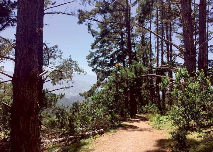
You’d be willing to work for these views, but the good news is you don’t have to. The trail carves its way between tall Monterey pine trees and offers views of Carmel Valley and Point Lobos. It’s a well-signed path, with nature walk placards describing species of flora and fauna.
Trailhead: Jacks Peak parking lot, 25020 Jacks Peak Park Road off Josselyn Canyon Road, Monterey. 755-1899, co.monterey.ca.us.
Route: From the parking lot, head uphill for a brief stretch, followed by primarily downhill walking. Follow signs for Skyline Nature trail, or for an uphill challenge, follow the Skyline Nature trail to the left on a wider path. Combine with the Iris and Rhus trails for a 3-mile loop.

Jacks Peak County Park
Fort Ord Dunes State Park | Beach Range Road
Length: 6 miles | Difficulty: Easy
OK, so it’s next to a highway, but it’s also next to 4 miles of coastline slowly returning to its original state as a native plant haven. Some longer sloping hills can make for a good workout on this otherwise easy route. Among the native shrubs are cypress trees and a couple of still-standing structures from the former Fort Ord. Graffiti on aging concrete structures offers an artsy contrast. Leashed dogs are allowed on paved paths.
Trailhead: 8th Street, overpass to west of Highway 1, Marina, 649-2836, parks.ca.gov
Route: From the parking lot, hang a left and head south. You can stay on the paved Rec Trail or go one way on sand (easiest at low tide) and make a loop. To log 6 miles, turn around after reaching the underpass at the Seaside/Sand City border. For extra mileage, start from the Marina entrance on Del Monte Boulevard near Reindollar Avenue.
Andrew Molera State Park | Ridge Loop
Length: 8.8 miles | Difficulty: Strenuous
Though much of Big Sur remains closed due to fires and floods, the wonders of Andrew Molera State Park are now partly open, including the strenuous trails to the west of Highway 1. While many come to build driftwood forts on the beach, or swim where the Big Sur River empties in the Pacific Ocean, the Ridge Loop shows what else is to be discovered, like redwood trees and nearby grazing cows.
Trailhead: 45500 Highway 1, Big Sur, 667-2315, parks.ca.gov.
Path: Take Creamery Meadow Trail to the Ridge Trail to the Panorama Trail, which as the name suggests, offers sweeping views. Connect to the Bluffs Trail for a relatively flat stretch along the coast to loop back to Creamery Meadow. This loop can be done in reverse, but walking down the narrow switchbacks of the Panorama Trail, plus the ocean-facing view, is recommended.
Monterey Veteran’s Memorial Park | Huckleberry Hill Loop
Length: 1.8 miles | Difficulty: Strenuous
Do not be fooled. This short hike packs a burst of pain into an otherwise ethereal experience. The reason is called the “the stairway to heaven,” the 183 wooden steps at the mouth of the loop that runs parallel to the Presidio. Once the climb is over, the trail levels off and offers views of Monterey Bay, occasional deer and towering pines. Go on a foggy morning or after an evening rain for extra-fragrant Monterey pines.
Trailhead: 12000 Veterans Drive, Monterey. The mouth of the trail begins at the parking lot closest to Chatswood Place. 646-3865, monterey.org.
Path: From the campground, head north to get on the trail, and take a sharp left in about 100 yards to go up the stairs. (You’ll see the Presidio property line, marked with a chain-link fence, to your right.) To make this hike even more hilly, start at the bottom of Quarry Park on Via Del Pinar (in the middle of a residential Monterey neighborhood), and follow signs for Veteran’s Park. This route offers added ocean and city views.
Fort Ord National Monument | Engineer Canyon Road Loop
Length: 3 miles | Difficulty: Easy
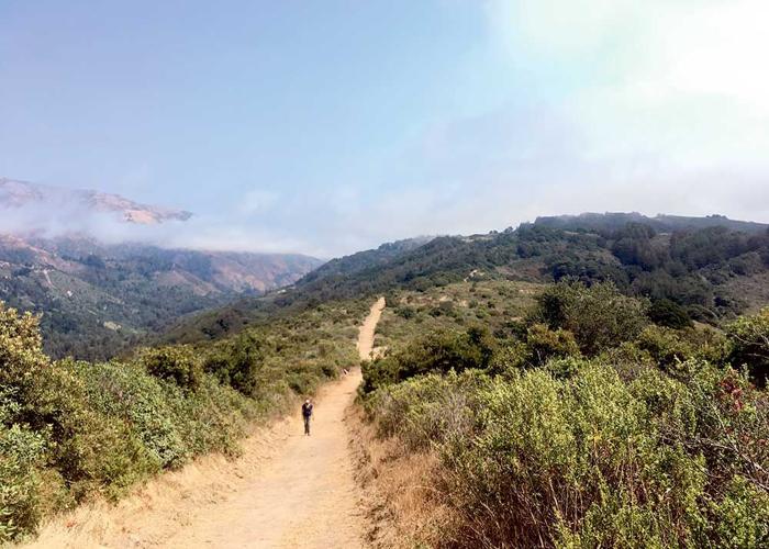
Popular with mountain bikers and joggers, Engineer Canyon Road is semi-paved. A few switchbacks carve through wizened oak trees, ending with a long stretch of dramatic cliff faces. View ag fields and the city of Salinas from the highest points of this hike. In the spring, wildflower blooms flood the western part of the trail.
Trailhead: Creekside Terrace from Portola Drive (off Reservation Road), Salinas, 582-2200, blm.gov.
Path: Take Old Reservation Road from the parking lot, and turn left to access Engineer Canyon Road. Detour onto Trail 32 to follow switchbacks into a shady grove of oak trees. Finish the loop on Engineer Canyon, following it back onto Old Reservation Road.
Pinnacles National Park | The Balconies Cave Loop
Length: 2.4 miles | Difficulty: Moderate
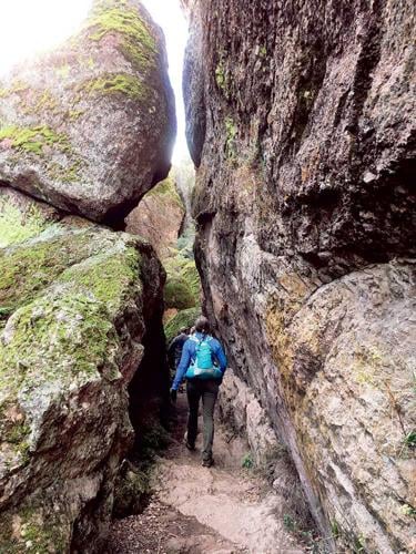
At first, it looks like it will be a brief challenge, a shimmy down a rocky surface. But upon lowering yourself into the Balconies Cave, first a full body length – then another and another – the point of light behind you vanishes, leaving darkness. The surrounding rocks are cold even on a hot sunny day, and the only source of light is flashlights.
It’s the towering red-hued spires, golden fields of wildflowers in springtime and soaring condors that get the most attention at Pinnacles – which was upgraded from a national monument to a national park in 2013 – all for good reason. But off-season spelunking is the most otherworldly experience to be had here. Across the park, the Bear Gulch Cave closes seasonally in the summer to protect the largest roosting maternity colony of Townsend’s big-eared bats found between Mexico and San Francisco, making fall prime time to visit. It’s also advisable to beat the summer heat. A flashlight is a must.
Trailhead: Highway 146, 14 miles east of Soledad, $15/entrance fee, 389-4486, nps.gov.
Path: Take the Balconies Cliffs Trail to go up and over the cave one way, then return on the Old Pinnacles Trail to walk through the cave. To add on six more steep and stunning miles, tack on the High Peaks loop trail.
(0) comments
Welcome to the discussion.
Log In
Keep it Clean. Please avoid obscene, vulgar, lewd, racist or sexually-oriented language.
PLEASE TURN OFF YOUR CAPS LOCK.
Don't Threaten. Threats of harming another person will not be tolerated.
Be Truthful. Don't knowingly lie about anyone or anything.
Be Nice. No racism, sexism or any sort of -ism that is degrading to another person.
Be Proactive. Use the 'Report' link on each comment to let us know of abusive posts.
Share with Us. We'd love to hear eyewitness accounts, the history behind an article.